UltimaX Terrain Texture Generator
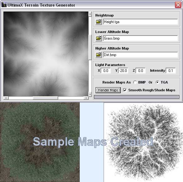
This will take a height map, lower altitude map, and a higher altitude map and blend them. It will output a rough map thats used for CLOD terrain engine, a shade map, a blend map, and a shaded blend map. For more information read the readme.txt. If you have any questions, feel free to ask. Enjoy this :)
Rate UltimaX Terrain Texture Generator
 (2(2 Vote))
Download UltimaX Terrain Texture Generator
Active Server Pages
Coding Standards
Complete Applications
Custom Controls
Data Structures
Databases / ADO
DDE
Debugging & Errors
DirectX
Encryption
Files / I/O
Games
Graphics
Internet / HTML
Jokes / Humor
Libraries
Math / Dates
Office / VBA
Miscellaneous
OOP
OLE / COM / ActiveX
Registry
Sound / MP3
String Manipulation
VB Enhancements
Windows API
Windows CE
System Services