GeoMaker Ver 2.0World GeoDatabase Maker Latitude, Longitude, Altitude for ever city in the world
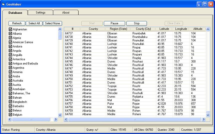
Create the GeoDatabase for the entire world. This program create the geographical location Latitude, Longitude, and Altitude (Elevation) for every city, village, region, state, county in the World. The program crawls the data from the website www.heavens-above.com which collect data from US Geological Survey for the USA (and dependencies) and The National Imaging and Mapping Agency for all other countries.Version 2.0 fixes the USA database issues and other fixes.
Rate GeoMaker Ver 2.0World GeoDatabase Maker Latitude, Longitude, Altitude for ever city in the world
 (3(3 Vote))
Download GeoMaker Ver 2.0World GeoDatabase Maker Latitude, Longitude, Altitude for ever city in the world
Active Server Pages
Coding Standards
Complete Applications
Custom Controls
Data Structures
Databases / ADO
DDE
Debugging & Errors
DirectX
Encryption
Files / I/O
Games
Graphics
Internet / HTML
Jokes / Humor
Libraries
Math / Dates
Office / VBA
Miscellaneous
OOP
OLE / COM / ActiveX
Registry
Sound / MP3
String Manipulation
VB Enhancements
Windows API
Windows CE
System Services