Earth in 3D, with basic GPS input
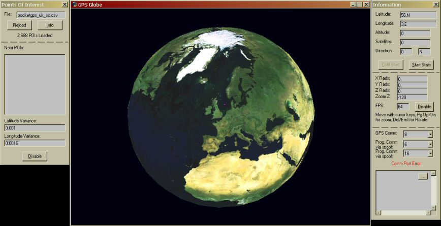
This views the a rotatable earth, if you connect a GPS it will show you the rough position on the globe with a pink square, but when you get on the other side of the planet the accurancy goes down by a dozen miles :( . You can load in a CSV file to inform you if your near a Long/Lat point..... It can record your movents and saves it in another csv file, so you view it on another program attached. I was planning to view the satellites it locks onto and make the earth more detailed when you zoom in on particular points. If I do - I'll upload it another time. This is a bit like a google earth clone.
Rate Earth in 3D, with basic GPS input
 (15(15 Vote))
Download Earth in 3D, with basic GPS input
Active Server Pages
Coding Standards
Complete Applications
Custom Controls
Data Structures
Databases / ADO
DDE
Debugging & Errors
DirectX
Encryption
Files / I/O
Games
Graphics
Internet / HTML
Jokes / Humor
Libraries
Math / Dates
Office / VBA
Miscellaneous
OOP
OLE / COM / ActiveX
Registry
Sound / MP3
String Manipulation
VB Enhancements
Windows API
Windows CE
System Services